Flexible Stratification
While the standard LDSF sites use a 10x10 km grid for stratification, the LDSF framework is highly flexible and can be adapted to various project needs. In many cases, it is desirable to stratify the locations of sampling clusters based on other criteria, such as:
- Ecological or agro-ecological zones: Ensuring representation across different climate or soil types.
- Land use or land cover types: Targeting specific environments like forests, croplands, or rangelands.
- Project or administrative boundaries: Aligning data collection with specific management areas or regions.
- Topography and elevation: Stratifying by slope or altitude in mountainous terrains.
Maintaining the Clustered Design
Regardless of the stratification criteria used to locate the clusters, the LDSF clustered sampling design remains the fundamental building block. This ensures that data collected in alternative designs is comparable with data from standard sentinel sites.
Core Sampling Units
- Clusters: The basic sampling unit remains a cluster, typically covering a 1 km² area. Cluster centroids are randomized within the chosen strata.
- Plots: Within each cluster, sampling plots are randomized as described in the LDSF sampling section.
- Subplots: The internal structure of each plot (1,000 m²) with its four subplots (100 m²) is strictly maintained to ensure consistent soil and vegetation measurements.
Examples of Alternative Designs
Stratification by Land Cover
In a project focused on forest restoration, clusters might be stratified based on forest density or time since restoration began. This allows for a more detailed assessment of indicators like tree biodiversity and soil organic carbon within specific forest successional stages.
Gradient-Based Sampling
For studies on landscape health along an intensification gradient, clusters can be located along a transect or within strata representing different levels of human impact or agricultural intensity.
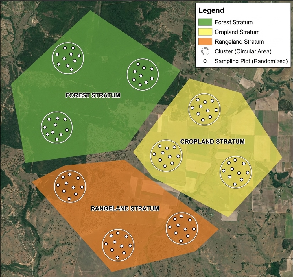
Stratified Sampling Illustration
The following illustration shows an example of a stratified random sampling design where land cover types (polygons) are used as strata (Forest, Cropland, and Rangeland). In this example, three circular clusters are randomized within each stratum, with 10 sampling plots further randomized within each cluster, maintaining the core LDSF protocol.